Statutory Instruments
2008 No. 1373
HIGHWAYS, ENGLAND
The Kingston upon Hull City Council (Scale Lane Bridge) Scheme 2008 Confirmation Instrument 2008
Made
20th May 2008
Coming into force in accordance with article 1
1. This Instrument may be cited as “The Kingston upon Hull City Council (Scale Lane Bridge) Scheme 2008 Confirmation Instrument 2008” and shall come into force on the date on which notice that it has been confirmed is first published, in accordance with paragraph 1 of Schedule 2 to the Highways Act 1980 .
2. The Kingston upon Hull City Council (Scale Lane Bridge) Scheme 2008 (“the Scheme”) is confirmed with modifications.
3. The Scheme as confirmed is set out in the Schedule (including the plans) and copies of the Scheme with its accompanying plans as modified are deposited at the offices of the Department for Transport, Floor 13 (IMD), Ashdown House, St Leonards on Sea, Hastings, East Sussex, TN37 7GA, and at the offices of the Kingston upon Hull City Council, Alfred Gelder Street, Hull, HU1 2AA (main reception).
Signed by authority of the Secretary of State for Transport,
J. Blackie
Regional Director Government Office for the North East
20th May 2008
THE SCHEDULE
The Kingston upon Hull City Council of The Guildhall, Alfred Gelder Street, Hull, HU1 2AA (“the Council”) makes this Scheme in exercise of its powers under Section 106(3) of the Highways Act 1980 and of all other powers enabling it in that behalf.
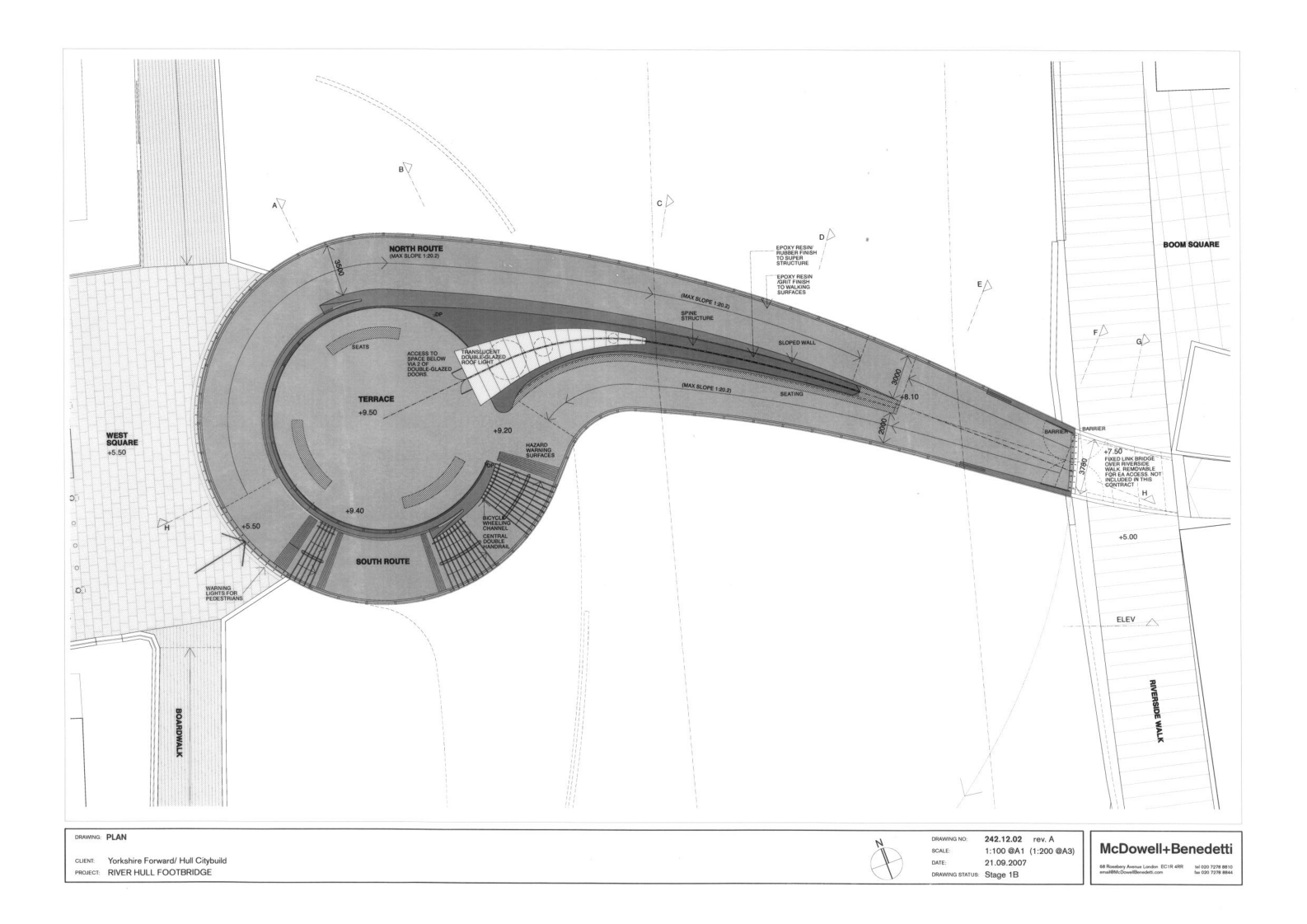
1. The Council is authorised to construct over the navigable waters of the River Hull the bridge specified in the Schedule to the Scheme, set out below, as part of the highway which is to be constructed and adopted between Scale Lane and Tower Street, Hull in the City of Kingston upon Hull.
2. This Scheme may be cited as the Kingston upon Hull City Council (Scale Lane Bridge) Scheme 2008.
THE SCHEDULE TO THE SCHEME PLANS AND SPECIFICATIONS OF THE SCALE LANE BRIDGE
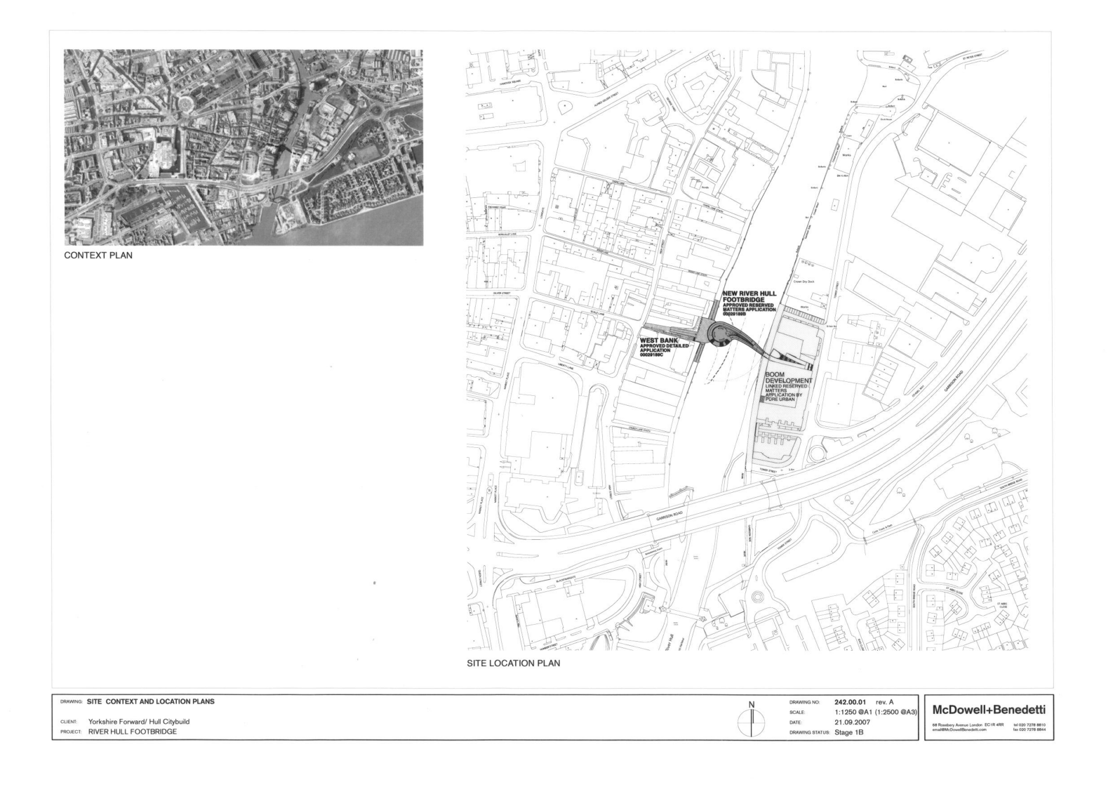
The location and general design of the Bridge are shown on the plans numbered 242.00.01 and 242.12.02 marked “Kingston upon Hull (Scale Lane Bridge) Scheme 2008” sealed with the Corporate Common Seal of the Council and deposited at The Guildhall, Alfred Gelder Street, Hull, HU1 2AA.
POINTS OF COMMENCEMENT AND TERMINATION
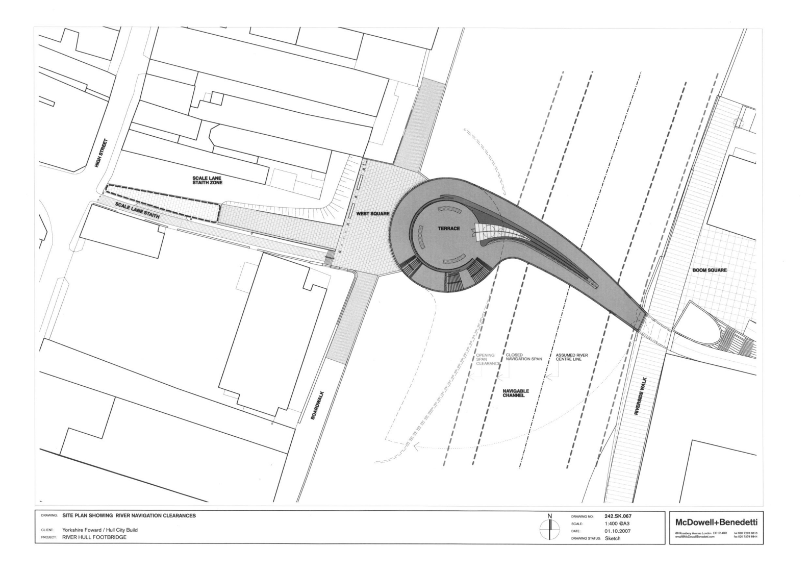
From a point on the west bank of the River Hull, approximately 150 metres north of the existing A63 Myton Bridge to a point on the east bank of the River Hull, West of Tower Street approximately 350 metres south of the existing Drypool Bridge as shown on plan 242.00.01.
SPAN
A single span of approximately 44 metres (about the centre of bridge rotation)
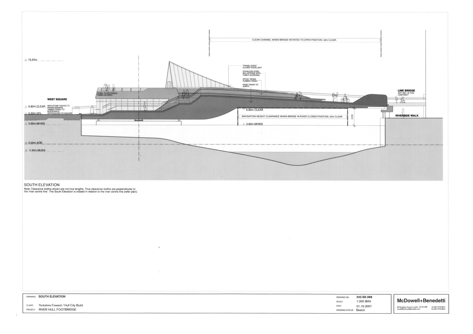
HEADWAY
In bridge closed to river traffic position
Not less than 3.20 metres above the mean high water spring tide level (MHWS) of 3.60 metres OAD.
In bridge open to river traffic position
Un-restricted
WATERWAY
In bridge closed to river traffic position
A minimum clear navigable waterway of 20 metres.
In bridge open to river traffic position
A minimum clear navigable waterway of 32 metres.
OVERALL DIMENSIONS
The Bridge will be of a variable overall width (maximum approximately 10 metres) over the navigation channel and will carry footways of a variable width (minimum 3 metres) on either side of the central supporting structure.
BRIDGE OPERATION
The bridge will be operationally governed by the daily tides and manned 2 hours and 50 minutes before high water and 2 hours after high water each day, except Sundays.
The bridge will be operated utilising 2-man crews who are rostered to work on a shift system and are managed by the River Hull Harbour Master who controls movement of vessels on the river and is an employee of the adopting Authority.
SI 1981/238 .